


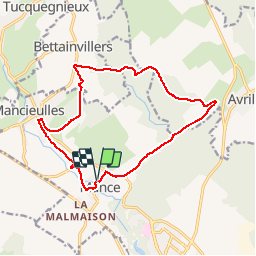

11,1 km | 13,8 km-effort


Gebruiker


Gratisgps-wandelapplicatie
 SityTrail
IGN / Geografische instituten
SityTrail World
De wereld gaat voor u open
Tocht Mountainbike van 13,8 km beschikbaar op Grand Est, Meurthe-et-Moselle, Val de Briey. Deze tocht wordt voorgesteld door TOTO54BR.
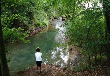
attention une partie doit se faire a pied car le chemin est tres etroit et la pente tres raide et en tres mauvais etat. c'est un chemin de randonnée ou les chevaux passent......

Te voet
Stappen

Paardrijden

Te voet

Mountainbike

Lopen
Trail

Stappen
Lopen